Elastic Maps Service
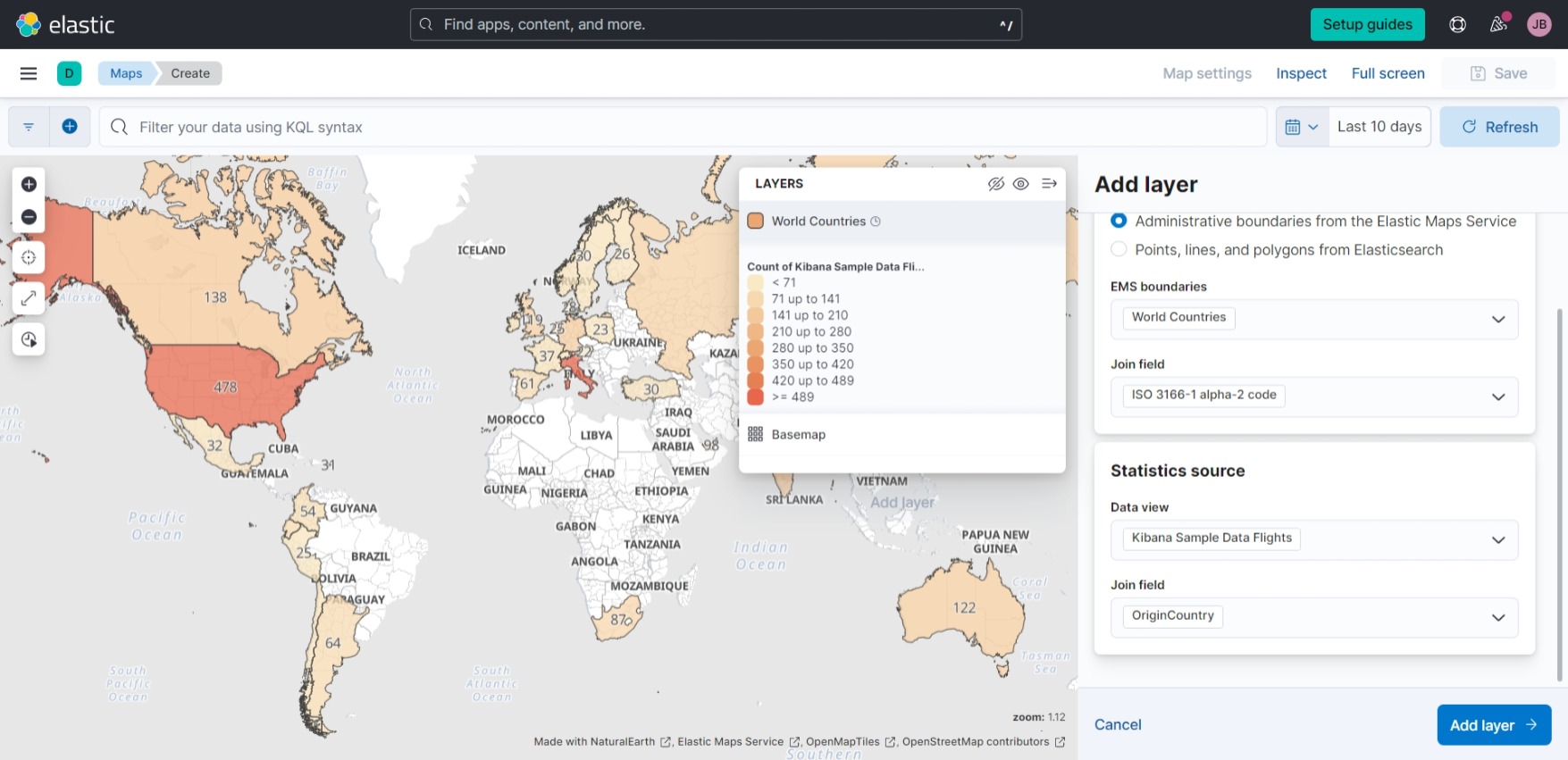
Kibana Sample Data Flights
Kibana Fundamentals Lab Guide | Elastic
How-to Series: Kibana | Elastic
timestamp,OriginCityName,DestCityName,Carrier,FlightDelayMin
"Apr 26, 2023 @ 11:58:20.000",Johannesburg,Sydney,"Kibana Airlines",255
"Apr 26, 2023 @ 11:53:34.000",Seoul,Hyderabad,"Kibana Airlines",360
"Apr 26, 2023 @ 11:50:34.000",Tokoname,Rome,"Logstash Airways",165
"Apr 26, 2023 @ 11:40:26.000",Bangor,"Jeju City","Logstash Airways",225
Elastic Stack Geospatial
Import geospatial data | Kibana Guide
amychan331/json-to-geojson
We use amychan331/json-to-geojson to convert AIS_2023_04_20.json to
AIS_2023_04_20.geojson. (See post on BarentsWatch AIS API.)
Elastic Maps Service
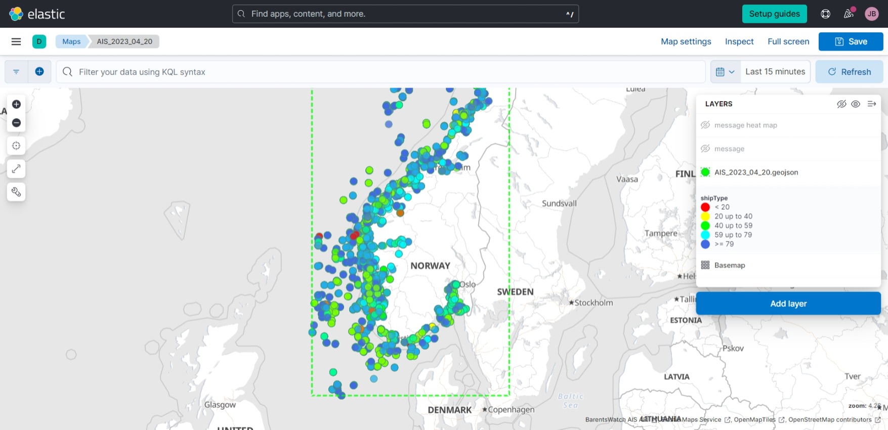
Messages in AIS_2023_04_20.geojson:
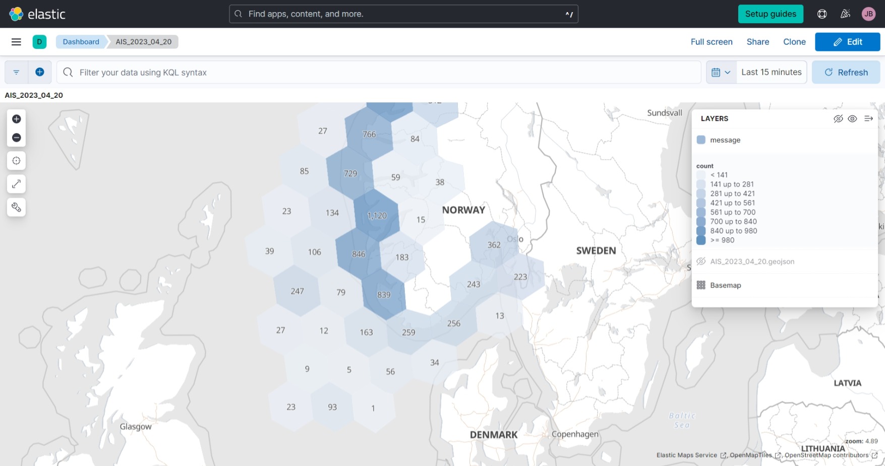
Cluster map with hexagons, by message count:
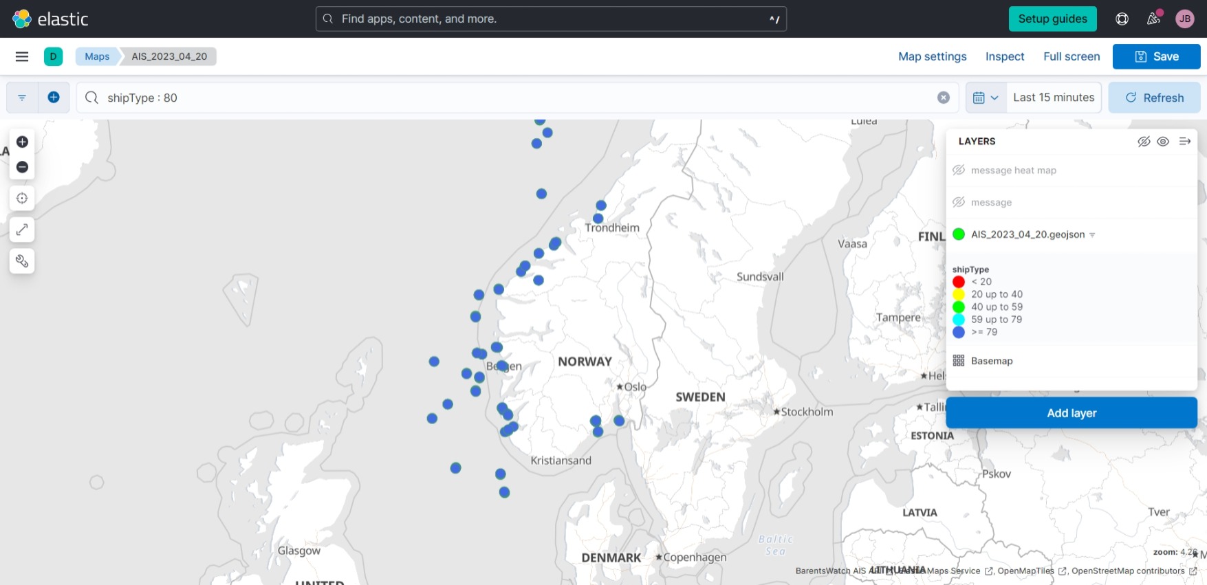
Applying filter shipType : 80 (tankers):
FleetMon Cargo AIS Data sample
The Sample Data Set contains all Cargo Container vessels over 100 meters with a time resolution of 6 hours on a single day (26.03.2020). The signal update frequency of the sample data is 6 hours. Furthermore, you receive the port calls of these container ships for the time period from 24.03.2020 00:00 until 28.03.2020 23:59 UTC.
In addition to the vessel positions, you can purchase the port calls of these vessels. A port call is the period of time during which the ship has been in a port zone and has come to a standstill.
Spire AIS sample
head -n 5 2020-06-26_Container_6h.csv
"MMSI","TimePosition","Latitude","Longitude","Speed","Course","Heading","NavStatus","TimeVoyage","IMO","Name","Callsign","VesselType","Draught","TimeETA","Destination"
"548770200","2020-03-26T00:00:00.000Z","6.923483","122.00095","0.0","206.0","108","at anchor","2020-03-25T23:55:14.000Z","8914556","MV SPAN ASIA 27","DUA3500","Cargo ship","7.5","2020-03-26T02:00:00.000Z","ZAMBOANGA PH"
"271047045","2020-03-26T00:00:00.000Z","38.322865","24.790733","14.9","207.3","206","under way using engine","2020-03-25T23:53:12.000Z","9211157","KOSOVAK","TCA5645","Cargo ship","9.6","2020-03-27T14:00:00.000Z","MISURATA"
"563052500","2020-03-26T00:00:00.000Z","53.532768","9.907048","0.0","28.3","306","under way using engine","2020-03-25T23:57:30.000Z","9283198","MONTE OLIVIA","9V6839","Cargo ship","11.2","2020-03-25T07:00:00.000Z","BEANR DEHAM"
"525019101","2020-03-26T00:00:00.000Z","-5.931","106.914283","8.7","197.4",,"under way using engine","2020-03-25T23:59:58.000Z","9672387","MV UMBUL MAS","POYJ","Cargo ship","4.3","2020-03-26T13:00:00.000Z","JAKARTA"
tail -n 1 2020-06-26_Container_6h.csv
"565846000","2020-03-26T23:55:58.000Z","35.235837","129.840278","9.6","235.6","236","under way using engine","2020-03-26T07:26:23.000Z","9675810","TACOMA TRADER","9V2401","Cargo ship","7.0","2020-03-27T05:00:00.000Z","KRPUS"
We will also use World Port Index (Pub 150) | National Geospatial-Intelligence Agency (NGA) to visualize ports on the map we are making.
head -n 1 UpdatedPub150.csv
World Port Index Number,Region Name,Main Port Name,Alternate Port Name,UN/LOCODE,Country Code,World Water Body,IHO S-130 Sea Area,Sailing Direction or Publication,Publication Link,Standard Nautical Chart,IHO S-57 Electronic Navigational Chart,IHO S-101 Electronic Navigational Chart,Digital Nautical Chart,Tidal Range (m),Entrance Width (m),Channel Depth (m),Anchorage Depth (m),Cargo Pier Depth (m),Oil Terminal Depth (m),Liquified Natural Gas Terminal Depth (m),Maximum Vessel Length (m),Maximum Vessel Beam (m),Maximum Vessel Draft (m),Offshore Maximum Vessel Length (m),Offshore Maximum Vessel Beam (m),Offshore Maximum Vessel Draft (m),Harbor Size,Harbor Type,Harbor Use,Shelter Afforded,Entrance Restriction - Tide,Entrance Restriction - Heavy Swell,Entrance Restriction - Ice,Entrance Restriction - Other,Overhead Limits,Underkeel Clearance Management System,Good Holding Ground,Turning Area,Port Security,Estimated Time of Arrival Message,Quarantine - Pratique,Quarantine - Sanitation,Quarantine - Other,Traffic Separation Scheme,Vessel Traffic Service,First Port of Entry,US Representative,Pilotage - Compulsory,Pilotage - Available,Pilotage - Local Assistance,Pilotage - Advisable,Tugs - Salvage,Tugs - Assistance,Communications - Telephone,Communications - Telefax,Communications - Radio,Communications - Radiotelephone,Communications - Airport,Communications - Rail,Search and Rescue,NAVAREA,Facilities - Wharves,Facilities - Anchorage,Facilities - Dangerous Cargo Anchorage,Facilities - Med Mooring,Facilities - Beach Mooring,Facilities - Ice Mooring,Facilities - Ro-Ro,Facilities - Solid Bulk,Facilities - Liquid Bulk,Facilities - Container,Facilities - Breakbulk,Facilities - Oil Terminal,Facilities - LNG Terminal,Facilities - Other,Medical Facilities,Garbage Disposal,Chemical Holding Tank Disposal,Degaussing,Dirty Ballast Disposal,Cranes - Fixed,Cranes - Mobile,Cranes - Floating,Cranes - Container,Lifts - 100+ Tons,Lifts - 50-100 Tons,Lifts - 25-49 Tons,Lifts - 0-24 Tons,Services - Longshoremen,Services - Electricity,Services - Steam,Services - Navigation Equipment,Services - Electrical Repair,Services - Ice Breaking,Services - Diving,Supplies - Provisions,Supplies - Potable Water,Supplies - Fuel Oil,Supplies - Diesel Oil,Supplies - Aviation Fuel,Supplies - Deck,Supplies - Engine,Repairs,Dry Dock,Railway,Latitude,Longitude
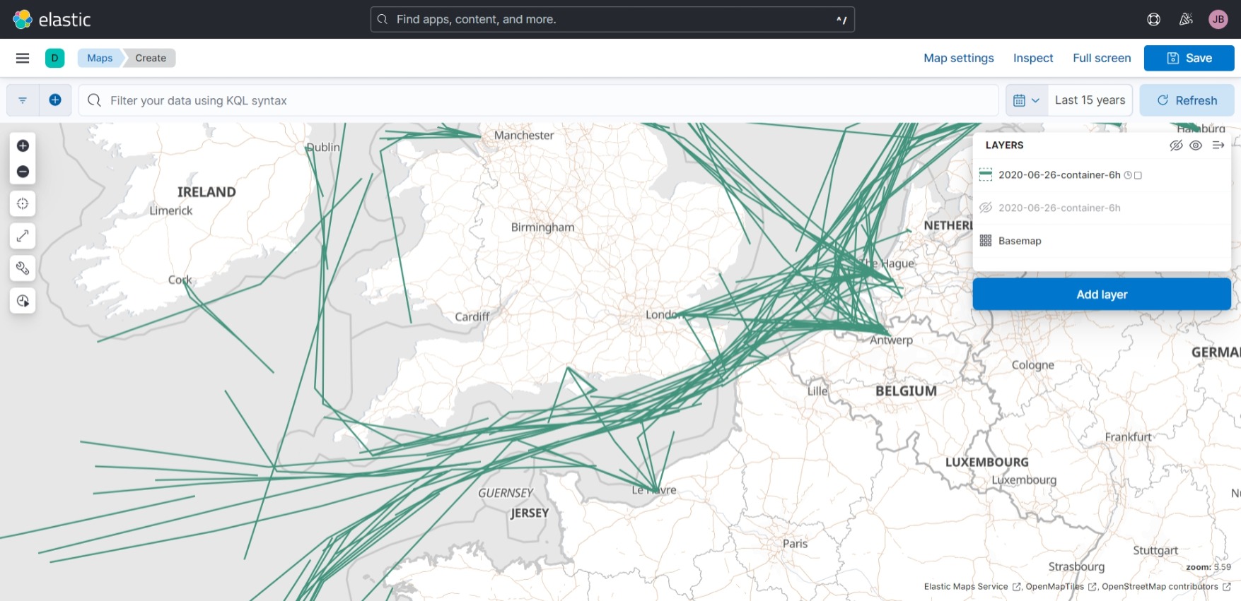
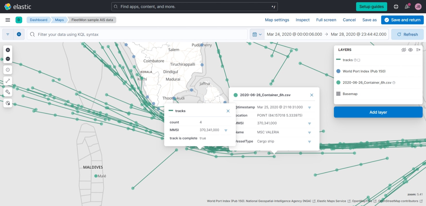
We create a layer from 2020-06-26_Container_6h.csv and choose “Tracks (Create lines from points)”. We create tracks according to
MMSI, order by timestamp.
Below we show the tracks created thus in the Indian Ocean:
and the English Channel:
