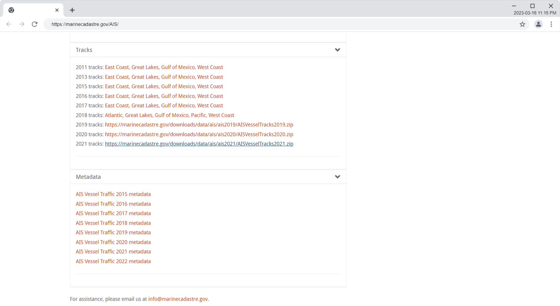
MarineCadastre.gov AIS Vessel Tracks using GDAL and QGIS
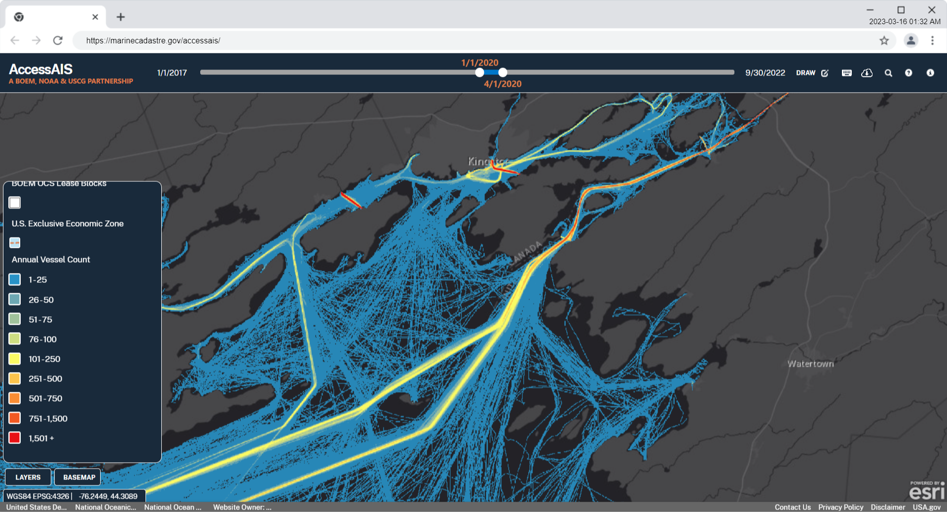
AccessAIS | BOEM, NOAA, U.S. Coast Guard Navigation Center
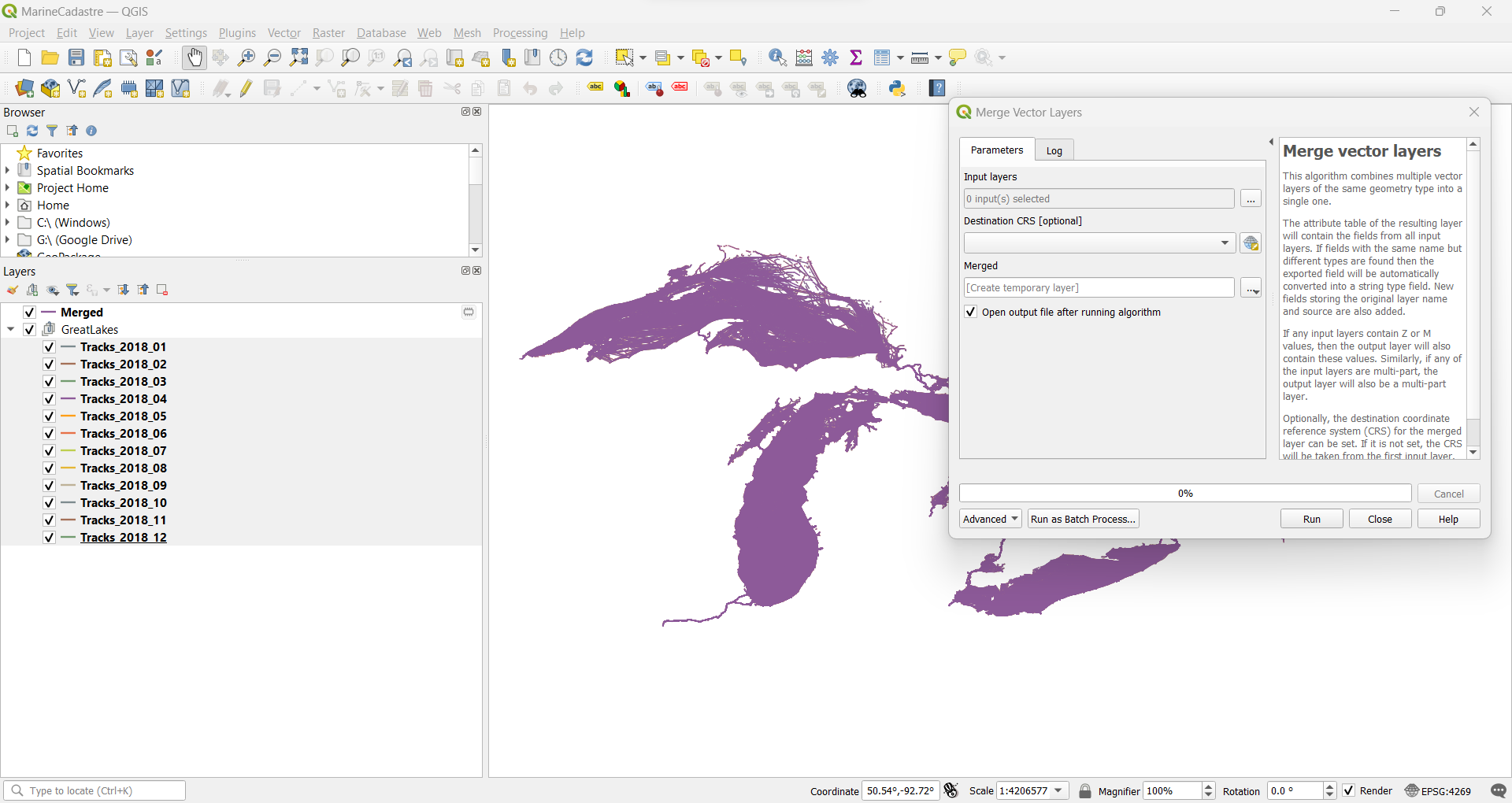
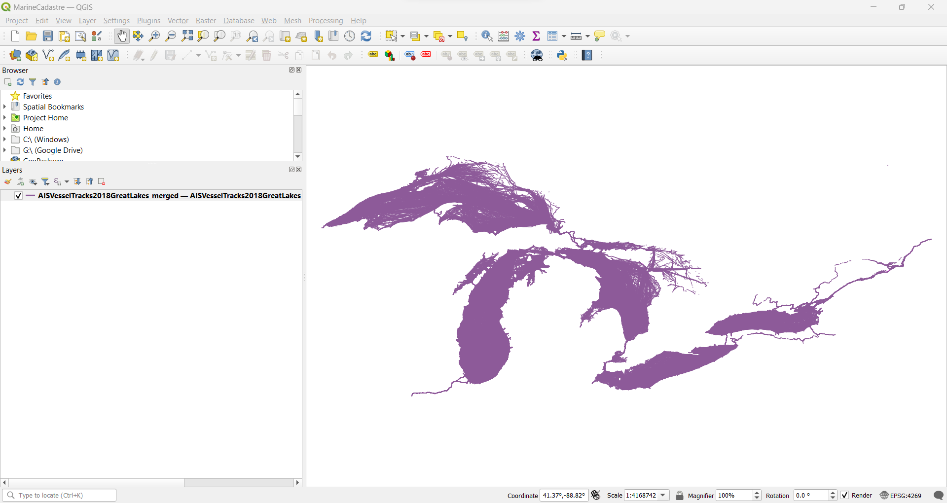
AISVesselTracks2018GreatLakes
GDAL documentation » Programs » ogrmerge.p
The following creates shapefiles from geodatabase files.
unzip AISVesselTracks2018GreatLakes.zip

ogr2ogr -f "ESRI Shapefile" AISVesselTracks2018GreatLakes GreatLakes.gdb
The following merges the shapefiles into a shapefile with a month field and makes a zip archive of the shapefile directory.
ogrmerge.py -single -o Tracks_2018_merged.shp Tracks_2018_*.shp -src_layer_field_name month

mkdir ../AISVesselTracks2018GreatLakes_merged

mv Tracks_2018_merged* ../AISVesselTracks2018GreatLakes_merged
Make zipfile of shapefile:
zip -r AISVesselTracks2018GreatLakes_merged.zip AISVesselTracks2018GreatLakes_merged
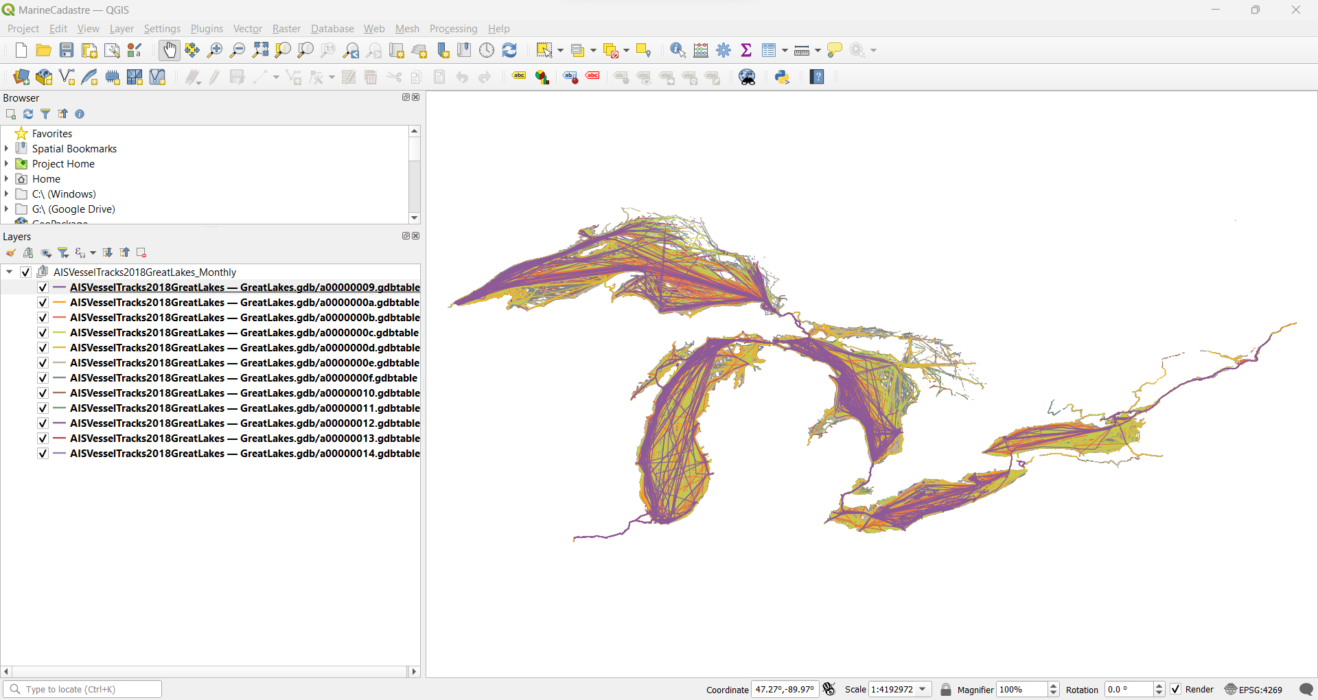
Merged with QGIS:
Merged with GDAL:
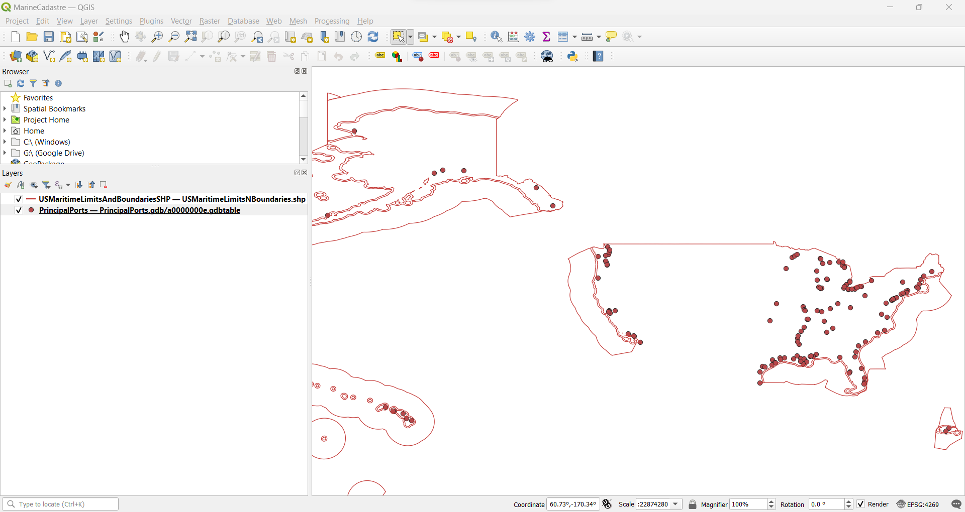
12NM Territorial Sea and Principal Ports